


Liefrange-Bavigne ok

anjodena
User
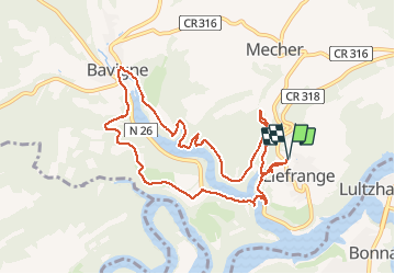

Length
9.5 km

Max alt
404 m

Uphill gradient
287 m
Km-Effort
13.3 km

Min alt
320 m

Downhill gradient
286 m
Boucle
Yes
Creation date :
2021-04-27 07:41:43.068
Updated on :
2021-04-27 15:56:13.664
2h36
Difficulty : Medium

FREE GPS app for hiking
 SityTrail
IGN / Geographical institutes
SityTrail Plus
The world is yours!
About
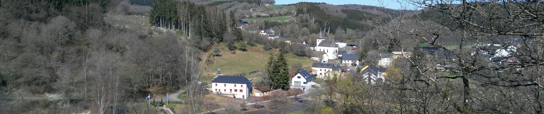
Trail Walking of 9.5 km to be discovered at Unknown, Canton Wiltz, Lac de la Haute-Sûre. This trail is proposed by anjodena.
Photos


Positioning
Country:
Luxembourg
Region :
Unknown
Department/Province :
Canton Wiltz
Municipality :
Lac de la Haute-Sûre
Location:
Unknown
Start:(Dec)
Start:(UTM)
706382 ; 5532781 (31U) N.
Comments
très belles vues sur les lacs